 Esabel Sadek
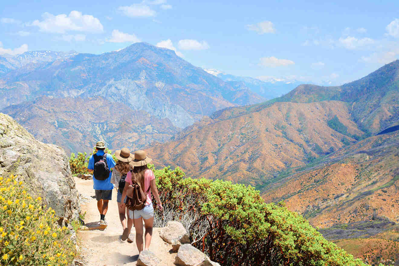
From desert floors and big city views to cliffside ocean views and snow-capped mountains, there are numerous scenic destination views to uncover through hiking in Southern California.
Being a native California girl, I’ve gone through phases of being an avid hiker, a hiker who just wants an easy trail with pretty views, and a hiker looking for all the hidden spots in SoCal. And, lucky for you, I’ve compiled a list of some of the best hikes in Southern California.
As always, I’ll be sharing some tips and tricks along the way to ensure you have the best experience possible while hiking in Southern California. If you decide to book any of the mentioned guided hiking tours below, make your experience that much more easy-going by booking in advance.
Pack your backpack, and let’s get started!
Contents
- Quick Picks for Your Stay
- 1. Torrey Pines State Beach Hiking Trail
- 2. Boy Scout Trail at Joshua Tree National Park
- 3. Devil’s Backbone Trail at Mount Baldy
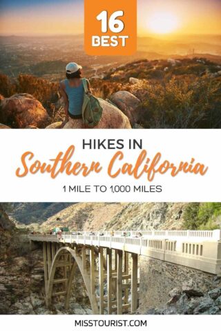
- 4. Bridge to Nowhere
- 5. Ski Hut Trail (Baldy Bowl Trail) at Mount Baldy (San Antonio)
- 6. Solstice Canyon Trail at Santa Monica Mountain
- 7. Brush Canyon Trail in Los Angeles County
- 8. Pacific Crest Trail
- 9. Cactus to Clouds Trail at the San Jacinto Mountains
- 10. Morro Canyon Trail at Crystal Cove State Park
- 11. San Clemente Beach Trail
- 12. Potato Chip Rock at Mount Woodsen
- 13. Main Trail at Malibu Creek State Park
- 14. Ryan Mountain Trail at Joshua Tree National Park
- 15. Smuggler’s Cove Trail at Santa Cruz Island
- 16. Escondido Falls
- FAQs about the best hikes in Southern California
- Conclusion
Quick Picks for Your Stay
Sometimes it’s just easier having someone hold your hand. I totally get it – especially if you’re not an avid hiker wanting to try a more advanced hike and don’t know how to take the necessary precautions to stay safe.
Here are the main things to book in advance:
- See the Hollywood Sign on this guided hike
- See cacti & mountains on this Palm Springs aerial tramway
- Hike through Malibu with a glass of wine
And here are the best hotels: Fairmont Century Plaza Los Angeles (luxury), Ravens Nest Ranch (mid-range), Hotel Mission De Oro (budget)
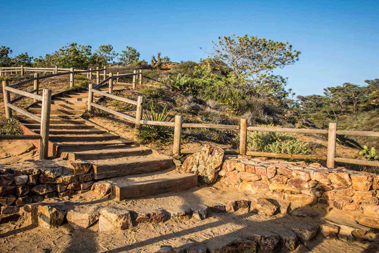
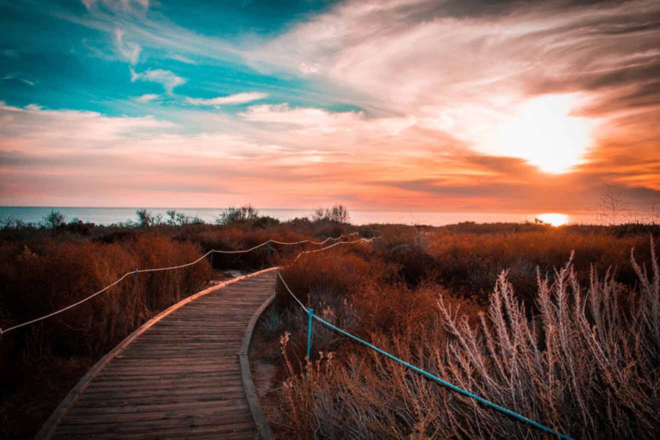
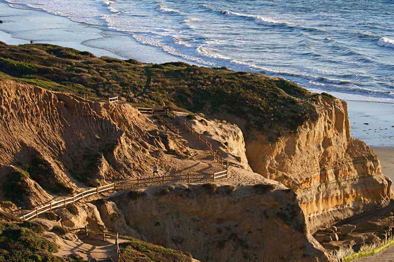
1. Torrey Pines State Beach Hiking Trail
📏 Distance: 2.3 miles (3.7 km)
⏱️ Time: 1.5 hours
📈 Difficulty: Easy
📍 Starting point: North Torrey Pines Road
📌 Endpoint: Torrey Pines State Beach
The Torrey Pines State Beach Hiking Trail Loop at Torrey Pines State Beach is my all-time favorite! I come here quite often for a nice sunset hike by the beach while admiring the Torrey Pine trees and the diversity of other flora that grows along the cliffside mountains. Sometimes I even see mountain bikers going up and down the pavement side, so bring your bike if you so please!
It starts on a road with a slight incline going up and gets easier within 15 minutes or so. This is not a strenuous hike, so I recommend bringing your family and friends to enjoy and go on an easy stroll around the stunning San Diego beach.
PRO TIP: Really take your time admiring the Torrey Pine Trees! These trees only grow in 2 places: Torrey Pines State Beach and the Channel Islands. So, they’re extremely rare and a novelty to see!
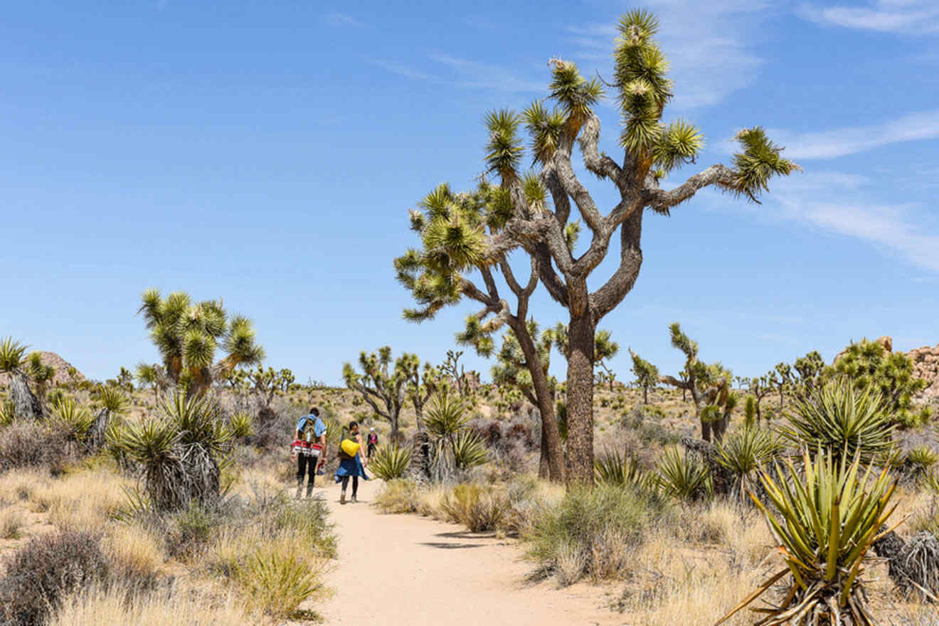
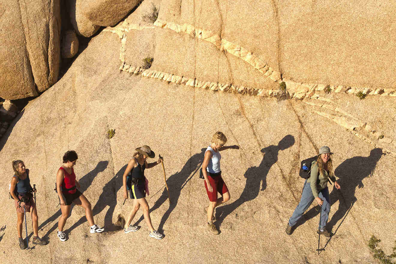
2. Boy Scout Trail at Joshua Tree National Park
📏 Distance: 8 miles (13 km)
⏱️ Time: 4 hours
📈 Difficulty: Advanced
📍 Starting point: Keys West Trailhead
📌 Endpoint: Indian Cove Campground
Planning a trip to Joshua Tree (here’s our scoop on the best areas to stay in Joshua Tree)? Boy Scout Trail is one of the most rewarding hikes in Joshua Tree National Park. The distance looping Boy Scout Trail is around 8 miles (13 km), with trail markers leading the way and an elevation gain hitting a maximum of 4,240 feet (c. 1,290 m).
This hike is quite long, and the days get hot in Joshua Tree, so I recommend going early in the morning (4 AM – 5 AM) during the fall and winter months. Expect to find breathtaking views of the famous Joshua Trees, the tallest peak in SoCal at the San Gorgonio Mountain, vistas, canyons, large rock formations, and cliffs.
NOTE: I do NOT recommend hiking any of these longer trails without the proper equipment, without prior advanced hiking experience, and before 4 or 5 AM.
Subscribe here to get up to 35% off your accommodation for your next trip!
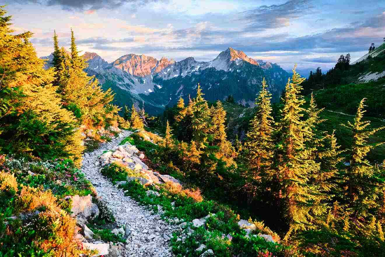
3. Devil’s Backbone Trail at Mount Baldy
📏 Distance: 14 miles (23 km)
⏱️ Time: 9 hours
📈 Difficulty: Advanced
📍 Starting point: Baldy Knotch
📌 Endpoint: Mt. Baldy Summit (Also known as Mount San Antonio Summit)
Devil’s Backbone Trail is as almost as intimidating as it sounds. It’s one of the most popular trails in the mountain town, Mt. Baldy Village. It’s located in the San Gabriel Mountains with captivating views of SoCal and the Mojave Desert.
The hike ends at Mt. Baldy, aka the highest point of the San Gabriel Mountains, standing at over 10,000 feet (c. 16,200 km). This trail is an excellent hike if you’re down for a challenging hike in the Los Angeles area.
The trail starts on a dirt road near Baldby Notch, where you can also extend your hike, where the trail crosses Baldy Bowl Trail or Mount Baldy Loop.
NOTE: You’ll need to get a Forest Adventure Pass while you’re at Mt. Baldy and a San Jacinto Wilderness Permit when you’re in the San Jacinto area! Buying an explorer pass is required at every major national recreation area in California. Click here for more information, here for free days, and click here to buy your pass.
4. Bridge to Nowhere
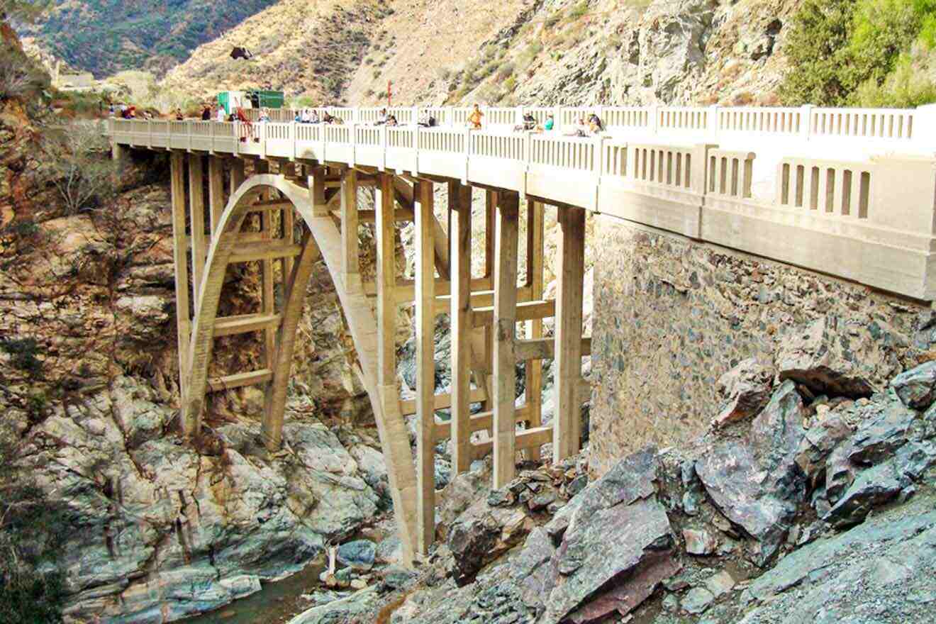
📏 Distance: 9.5 miles (15.3 km)
⏱️ Time: 5.5 hours
📈 Difficulty: Moderate to Advanced
📍 Starting point: East Fork of the San Gabriel River
📌 Endpoint: Bridge to Nowhere
The Bridge to Nowhere was built in 1936 as part of a project connecting roads from San Gabriel Valley with Wrightwood, California. The project (known as the East Fork Road) was abandoned due to floods, leaving the bridge stranded in what we now know to be Sheep Mountain Wilderness. Today, you can still find parts of asphalt along the East Fork Trail leading to the bridge!
The hike is 9.5 miles (15.3 km) round-trip with plenty of washed-out sections, intersecting trails, and streams crossing along the way. There’s a ton to see, so I recommend coming early in the morning and taking your time on your way to the bridge. It’s also very busy, so being here early in the morning and/or on weekdays will be good to help avoid crowds.
NOTE: I like to bring protein bars whenever I’m hiking! Avoid bringing anything with chocolate since they easily melt. I prefer bringing these protein smoothies because they don’t require any refrigeration, taste delicious, and they’re mess-proof.
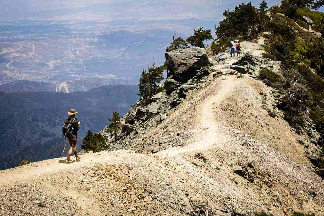
5. Ski Hut Trail (Baldy Bowl Trail) at Mount Baldy (San Antonio)
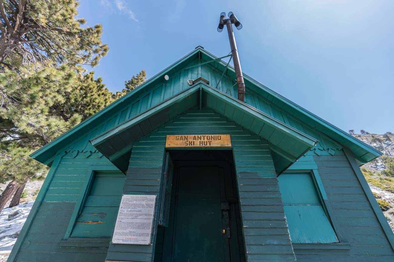
📏 Distance: 4.6 miles (7.4 km)
⏱️ Time: 4 hours
📈 Difficulty: Moderate
📍 Starting point: Manker Flats Campground
📌 Endpoint: The highest point in the San Gabriel Mountains
Ski Hut Trail, otherwise known as Baldy Bowl Trail, is located in the Angeles National Forest. It climbs about 3,900 feet over the course of 4.6 miles (7.4 km) and ends at the highest peak in the San Gabriel Mountains located in the San Gabriel Valley. On the way, you’ll see the Sierra Club Ski Hut, which I recommend stopping by for a quick water break.
It is quite a moderate hike with inclinations throughout the 4-hour journey, so come prepared! It’s worth it at the top, where you’ll find the panoramic mountain views of Mount San Gorgonio, Mount San Jacinto, and Santiago Peak.
NOTE: Don’t forget to buy your adventure pass beforehand and make sure to check the weather before starting your hike here (or anywhere in Southern California) – there are avalanches and strong trail winds everywhere that you need to watch out for!
6. Solstice Canyon Trail at Santa Monica Mountain
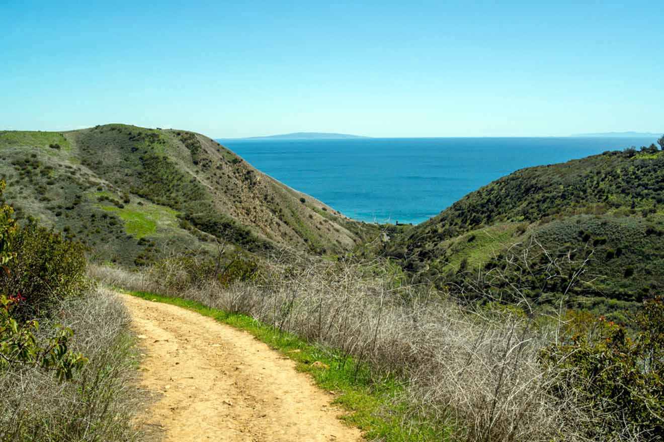
📏 Distance: 3 miles (5 km)
⏱️ Time: 1.5 hours
📈 Difficulty: Moderate
📍 Starting point: Solstice Canyon Road
📌 Endpoint: Santa Monica Mountains Viewpoint
Malibu’s Solstice Canyon Loop Trail is a moderate hike down the Santa Monica Mountains through a shaded canyon! It’s a super popular route that branches out into different trails if you want to change things up and go on different routes along the way.
Within the 1.5 hours of hiking, you’ll find many pieces of history: the oldest stone building in Malibu, a rushing waterfall, a creek, and the ruins of an old mansion, Roberts Ranch House!
NOTE: Take the Rising Sun Trail heading up to the ridge, giving you amazing views of the Pacific Ocean. This is where you’ll find the mansion ruins, exotic flora, and even a hidden statue of the Virgin Mary.
7. Brush Canyon Trail in Los Angeles County
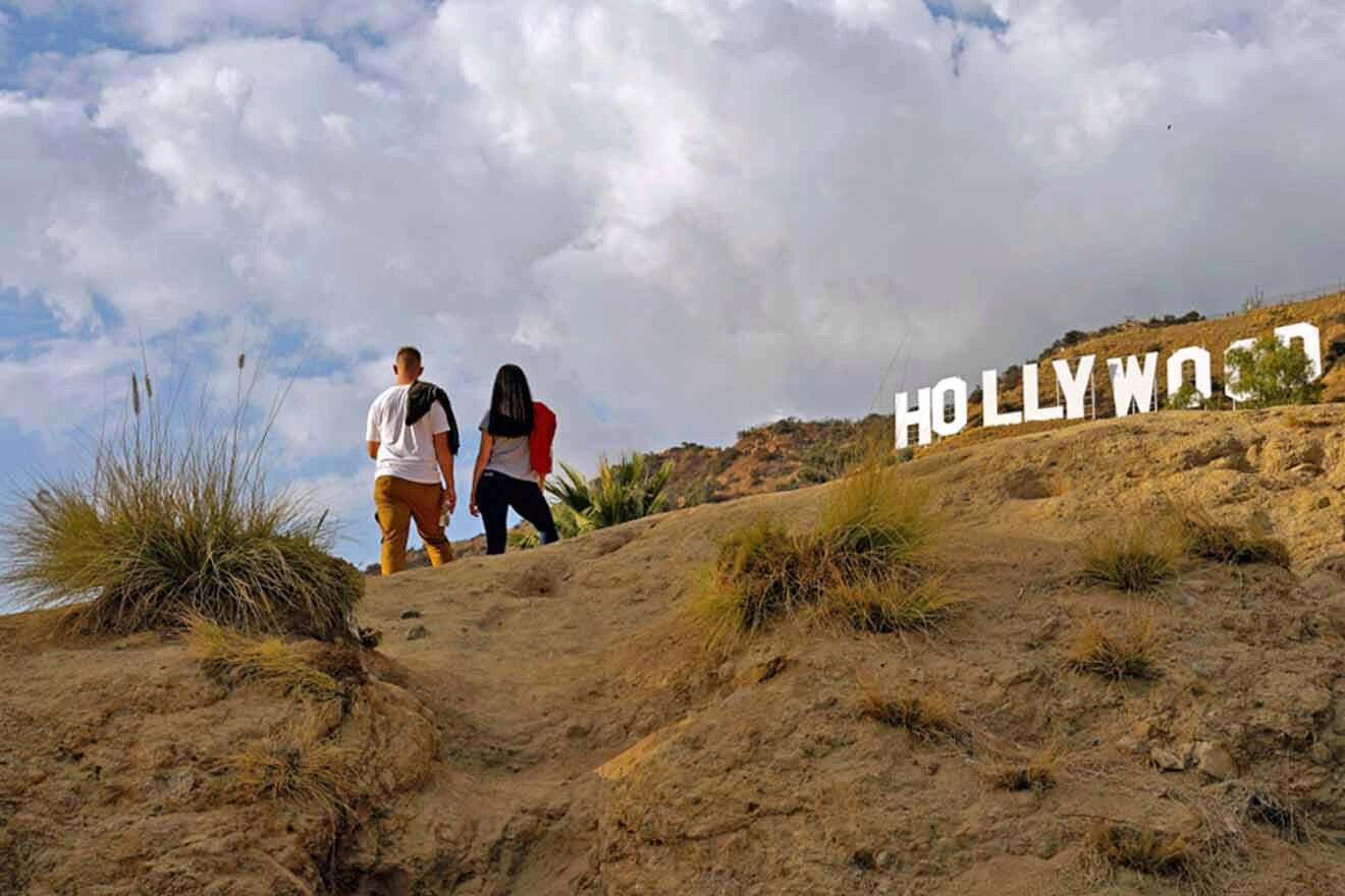
📏 Distance: 4.7 miles (7.6 km)
⏱️ Time: 2.5 hours
📈 Difficulty: Moderate
📍 Starting point: Canyon Drive
📌 Endpoint: Hollywood Sign
Brush Canyon Trail is a steep hike in Griffith Park, leading you to the famous Hollywood Sign! This hike is incredibly popular, so it tends to get busy during the weekends and sunset hours. I recommend going around 4 AM or 5 AM to catch a glimpse of the sunrise at the peak and avoid the large crowds.
You can take advantage of the free street parking if you’re here early enough. Otherwise, the street parking will probably be completely occupied if you’re here when everyone else is, so park at the Griffith Observatory (and take the chance to tour it while there)!
If you’re interested in more hand-holding while you’re hiking to the Hollywood Sign, go on a tour like this one and let the pro guide lead the way!
TOUR PRICE: from US$25
8. Pacific Crest Trail
📏 Distance: 2,591 miles (4,170 km)
⏱️ Time: 5 months
📈 Difficulty: Advanced
📍 Starting point: Highway 94 & Campo, Mexico/US Border
📌 Endpoint: Boundary Monument 78, Canada/US Border
Pacific Crest Trail is an entire mission designed for avid hikers to embark on an adventure of a lifetime. Starting in Campo, near the Mexico border in San Diego, going through the Sierra Nevada Mountains, and ending at Boundary Monument 78, the Canada/USA border in Washington, this 5-month excursion might sound like a dream come true for some of you.
Many people don’t know about this hike since it’s not as easily accessible to your everyday hiker. You’ll need to get a permit to complete this hike while mentally and physically preparing for the hike. There are 4 permits you’ll need: California Fire Permit, Canada PCT Entry Permit, PCT Long Distance Permit, and local permits you’ll need for traveling in specific areas. I recommend reading about them here.
NOTE: Deciding to embark on the Pacific Crest Trail is a 5-month commitment for adventurers and hikers that have experience with advanced hikes. If that sounds like you, this hike is for you!
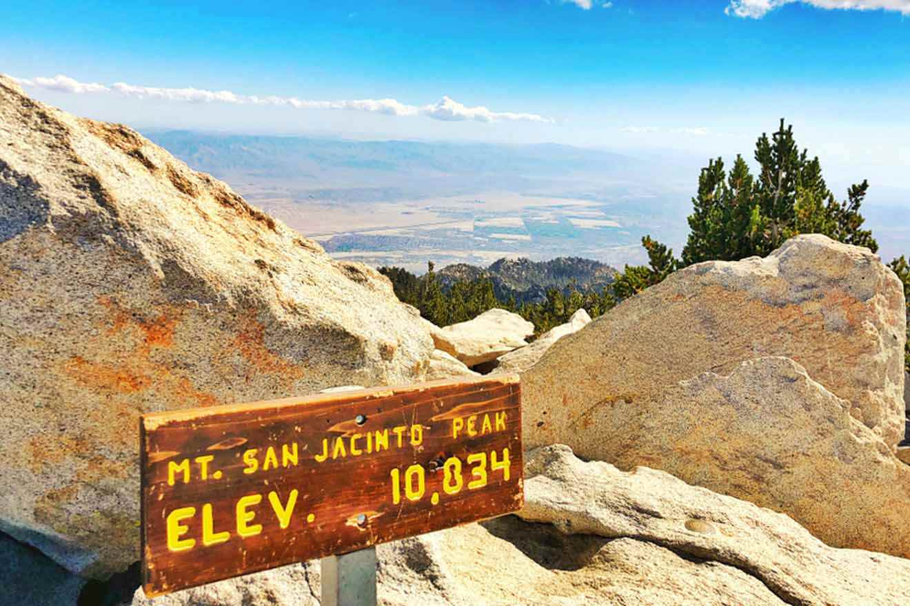
9. Cactus to Clouds Trail at the San Jacinto Mountains
📏 Distance: 21 miles (34 km)
⏱️ Time: 15 hours
📈 Difficulty: Advanced
📍 Starting point: Palm Springs
📌 Endpoint: San Jacinto Mountain Peak
Cactus to Clouds Trail is a round-trip trail of about 21 miles (34 km), where you’ll experience the highest elevation gain of any hiking trail in the country, from the desert of Palm Springs to the highest peak of San Jacinto Mountain. The trail is meant for advanced hikers looking for a challenge.
The elevation gain is about 8,000 feet (c. 2,440 m) in the first 12 miles (c. 20 km) or so hiking through the dry desert. While this is a very rewarding hike in the end, there have been many reports of people being injured or lost on this trail, so this isn’t for the faint-hearted! I don’t recommend this for the everyday-casual-hiking type of person, but rather for the professional hiker with experience going on excursions like this.
With that said, if you want to skip the hike entirely and watch the views drastically change from the desert to the mountains, you can take the Palm Springs Aerial Tramway up and down the mountain instead! This is an excellent experience if you’re staying in Palm Springs and want a taste of the stunning views from the world’s largest revolving cable car.
TRAMWAY PRICE: US$30 per person
10. Morro Canyon Trail at Crystal Cove State Park
📏 Distance: 5 miles (8 km)
⏱️ Time: 3 hours
📈 Difficulty: Moderate
📍 Starting point: El Moro Visitor Center
📌 Endpoint: El Moro Canyon
El Moro Canyon Loop Trail near Crystal Cove State Park is a moderate hike for the everyday person looking for a little challenge. It climbs about 800 feet in elevation (c. 240 m) and offers you a beautiful coastline view! It’s also not too steep, so it’s not strenuous.
Many people ride horseback through this trail, mountain bike, and walk on the daily. It’s one of the most popular hiking trails in the Crystal Cove State Park area, so keep that in mind and plan your hike ahead of the crowd! I recommend renting a bike from the nearby shop Laguna Beach Bums and enjoying the ride to the trailhead and through the trail.
PRO TIP: I’ve been putting these footbeds in my shoes anytime I’m hiking! It actually saves me the next day from back and foot pain. I recommend trying them out!
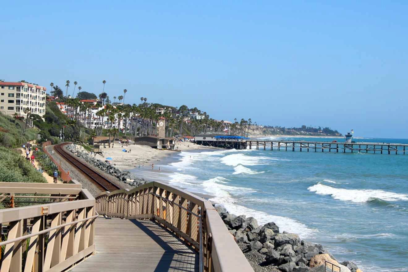
11. San Clemente Beach Trail
📏 Distance: 4.5 miles (7.2 km)
⏱️ Time: 2 hours
📈 Difficulty: Easy
📍 Starting point: San Clemente State Beach
📌 Endpoint: Pier Bowl Trailhead
The 1 – 2-hour San Clemente Beach Loop Trail at San Clemente Beach is one of the most beautiful Southern California hikes. With picturesque views of the ocean and the preservation of the small beach town feel in San Clemente, this is an easy breezy walk down the Pacific Coast.
The trail ends at the Pier Bowl area, where you can grab a bite to eat after your 2-hour walk. I recommend going to the Fisherman’s Restaurant & Bar, the most popular eatery among locals, and checking out their happy hour specials.
PRO TIP: Make sure to slather on your sunscreen! I recommend this UV-protecting sunscreen from Shiseido for your face and this easy spray-on sunscreen for the rest of your body (and make sure to reapply throughout the day, too)!
12. Potato Chip Rock at Mount Woodsen
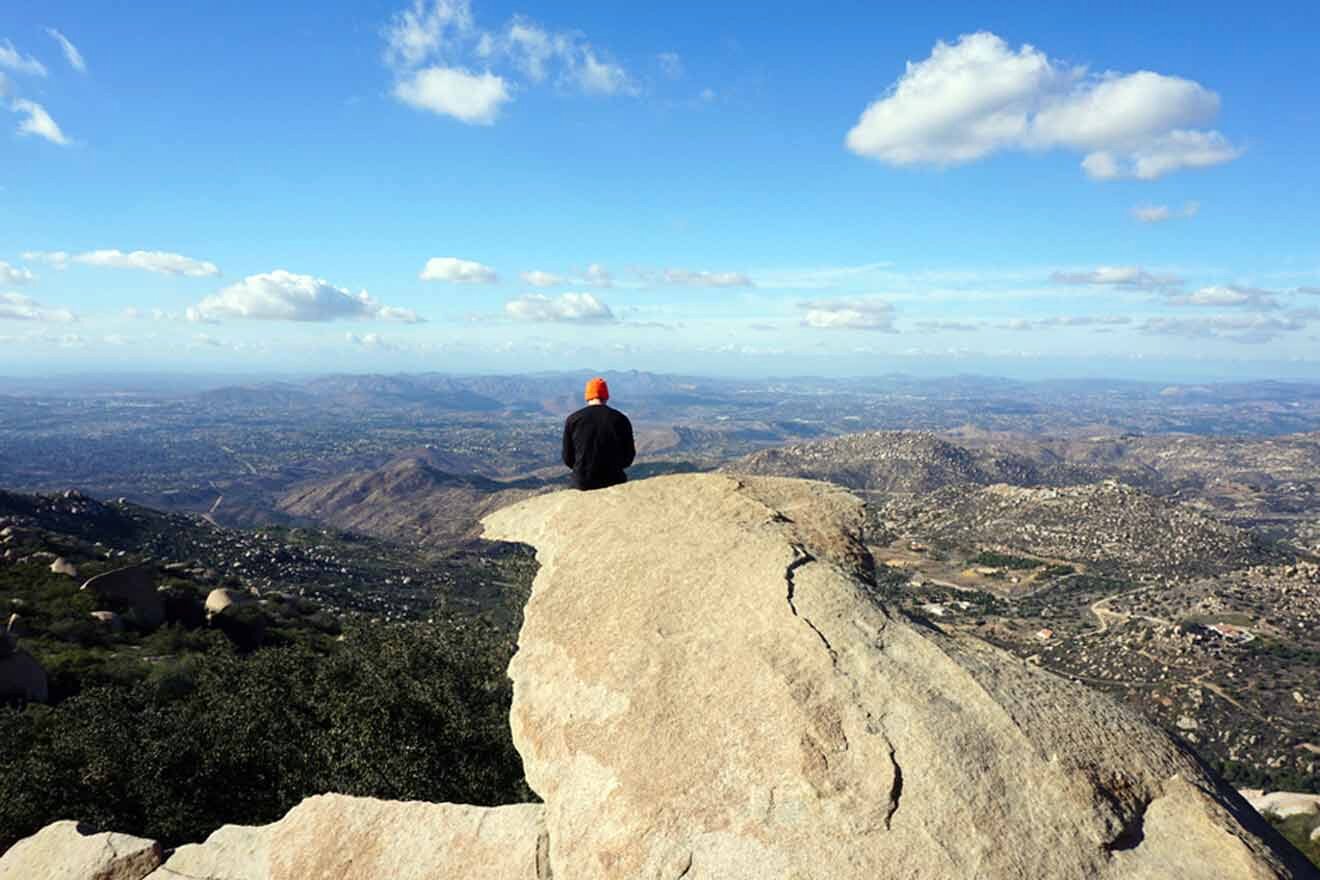
📏 Distance: 7.4 miles (12 km)
⏱️ Time: 5 hours
📈 Difficulty: Moderate
📍 Starting point: Mount Woodson
📌 Endpoint: Potato Chip Rock
Potato Chip Rock, also known as Mount Woodson Trail, is a popular hike among Northern San Diego County locals! It’s a steep, narrow hike through Mount Woodson up to the tip-top by the famous boulder shaped like a potato chip. The unique rock formation at the top attracts tons of visitors and locals here every day.
The location of the hike, being between Poway and Ramona, is more inland and nowhere near the ocean. Because of this, it’ll feel like the sun is beating harder on you. Also, the last time I was here, I got sunburned because there was no shade on the way up. I recommend wearing sunscreen, a wide-brimmed hat, and bringing tons of water to stay hydrated.
NOTE: Lake Poway parking is free during the week and US$10 for non-Poway residents during the weekends and holidays. Plan your hike during the week to avoid having to pay this fee!
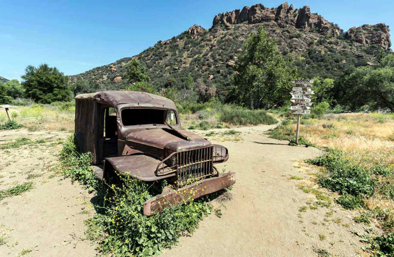
13. Main Trail at Malibu Creek State Park
📏 Distance: 15 miles (24 km)
⏱️ Time: 12 hours
📈 Difficulty: Moderate
📍 Starting point: Malibu Creek State Park
📌 Endpoint: Malibu Lagoon
Malibu Creek State Park has 15 miles (24 km) of nature trails to uncover! You’ll find breathtaking views of vistas, oak and sycamore trees, the Las Virgenes Valley, and Malibu Canyon. This area was the center of Native American life, with the Mott Adobe ruins left behind to tell the story today!
It’s located a short drive away from the Pacific Coast Highway, making this an easy stop to explore if you’re driving up the coast from San Diego to San Francisco. The entrance is past the Mulholland Drive intersection.
NOTE: If you enjoy the finer things in life and would rather spend your time in Malibu with a glass of wine in one hand while taking a guided hike through the Malibu Hills, I recommend checking out this tour! It’s an excellent group tour for solo travelers who want to take on Malibu differently.
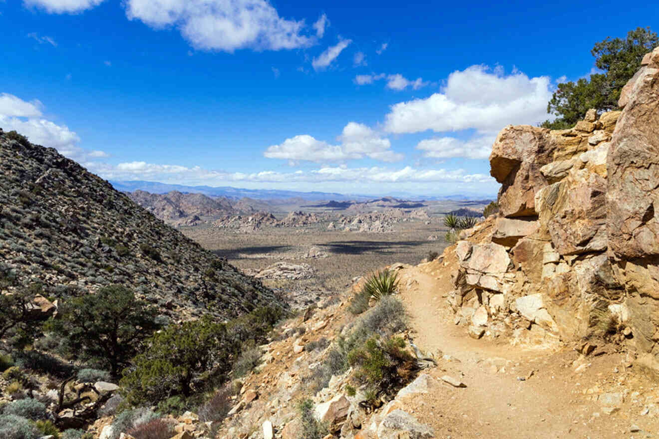
14. Ryan Mountain Trail at Joshua Tree National Park
📏 Distance: 2.9 miles (4.7 km)
⏱️ Time: 2.5 hours
📈 Difficulty: Easy to Moderate
📍 Starting point: Between Ryan Campground and Sheep Pass Campground
📌 Endpoint: Ryan Mountain Peak
Ryan Mountain Trail in Joshua Tree National Park is an absolute must for the most captivating 360-degree views of the desert. The 2.9-mile (c. 5 km) trail begins with an easy flat walk and gains elevation as you head up the mountain.
I recommend going early in the morning to avoid the sun hitting you during peak afternoon hours. The desert is quite dry and hot, so plan on visiting the national park during the winter and fall months! If you’re not able to hike in the morning (before sunrise is best), I recommend hiking right before the golden hour so you can catch the sunset and it’s not quite as hot.
NOTE: Before embarking on this trail or any trails on this list, it’s important to remember that weather and wind conditions may affect trail closures. I recommend checking the weather and planning accordingly.
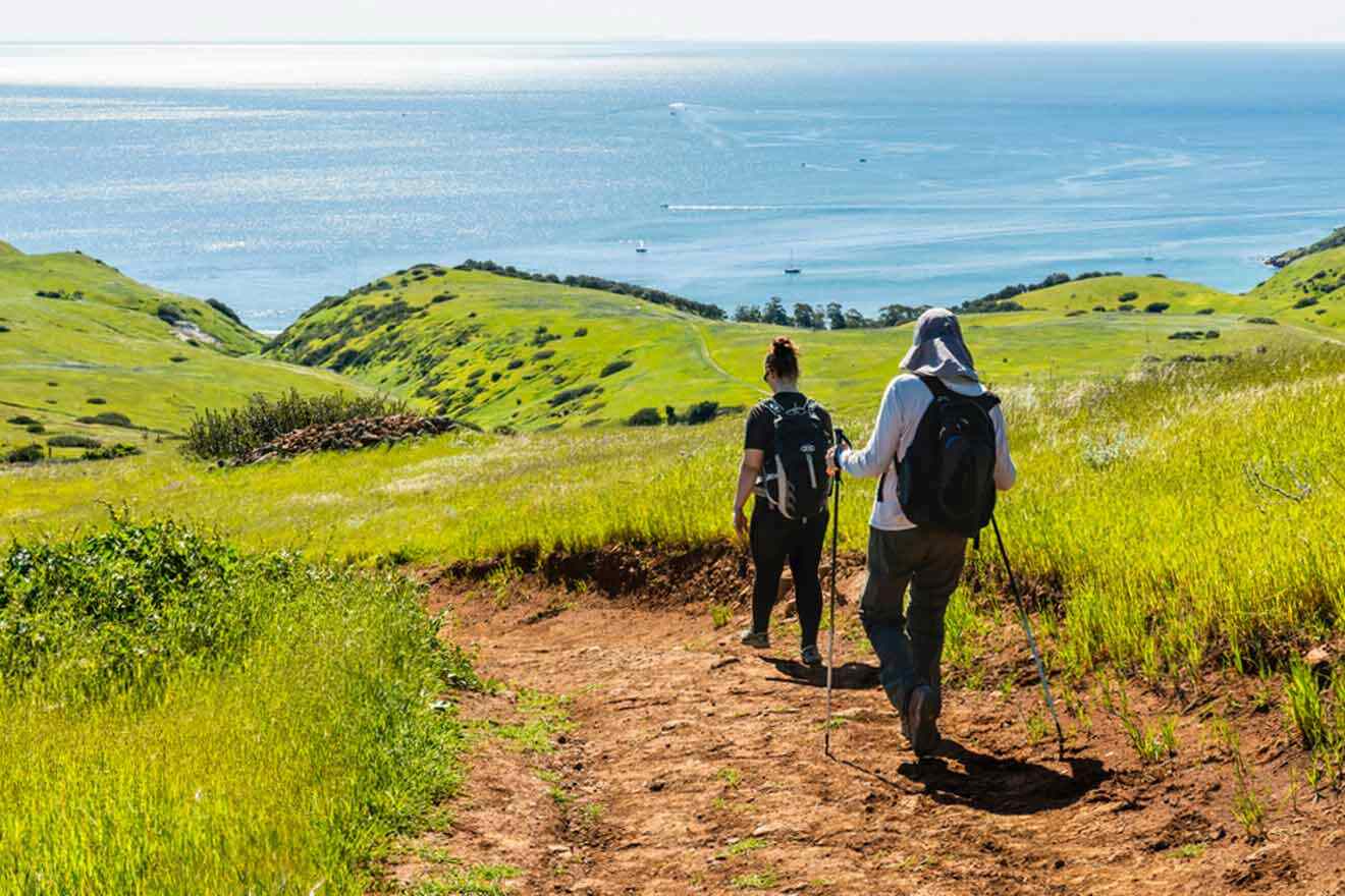
15. Smuggler’s Cove Trail at Santa Cruz Island
📏 Distance: 7.7 miles (12.4 km)
⏱️ Time: 4 hours
📈 Difficulty: Moderate
📍 Starting point: Scorpion Beach
📌 Endpoint: Smuggler’s Cove
Smuggler’s Cove Trail in Santa Cruz Island is one of the most beautiful hikes while also not being the most popular hike in Southern California. It takes quite some effort to come here since you’ll need to take a boat to Santa Cruz Island and then start your journey. Unlike a few others on this list, it’s not as convenient. This is great because it doesn’t get as crowded!
I recommend taking a boat from Venture to Scorpion Beach on Island Packers. It’s about a 1-hour journey.
There are a few spur trails leading you to different areas that you can explore. I recommend making the most out of this experience and checking it out. At the same time, it’s important to be aware of your surroundings and get back on the original trail so you don’t get lost on the island.
PRO TIP: Bring trekking poles to keep up with your long journey!
16. Escondido Falls
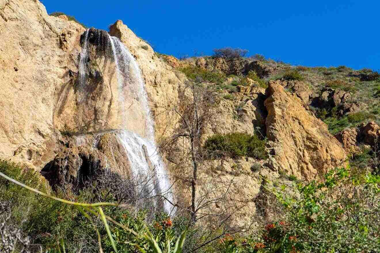
📏 Distance: 3.7 miles (6 km)
⏱️ Time: 2 hours
📈 Difficulty: Moderate
📍 Starting point: Pacific Coast Highway
📌 Endpoint: Escondido Falls
Escondido Falls Trail is a short day trip away to Malibu – it’s the ultimate adventure with multiple stream crossings and beautiful wildlife passing by. Locals come here for bird watching and mountain biking, so you’ll get to mingle with fellow SoCal natives and avoid the tourists. The hike is about 3.7 miles (6 km) roundtrip in total, and you end up at a 150-foot (45+ m) cascade with 2 overlapping tiers.
If you don’t have too much time, you can end the hike after about one mile in. At the mile mark, you’ll end up at Lower Escondido Falls, which is the first waterfall reaching about 50 feet (15 m). You still get the view of a stunning waterfall, but you skip the (steep) second half of the hike.
PRO TIP: Get ready for some rock hopping and getting your feet wet! Bring an extra pair of socks and wear hiking boots with a tight grip. It gets very slippery, so you want to make sure you’re prepared beforehand. I recommend the Lowa Renegade GTX Mid Hiking Boots!
HACK: The waterfall and views are 100% better and brighter when you go in the spring! Plan your trip around this time of year to make the most out of your experience.
PRICE: Entrance into the park is free. However, parking by Winding Way is US$12.
| 🥾 Easiest hike: | Salt Creek Interpretive Trail |
| 👨👩👧 Best hike for kids: | Torrey Pines State Beach |
| ⛰️ Best views: | Solstice Canyon Trail |
| 🗺️ Best guided hike: | Malibu Wine + Hike Tour |
FAQs about the best hikes in Southern California
📈 What is the most difficult hike in Southern California?
The most difficult hike in Southern California is the Pacific Crest Trail. This 5-month expedition is only meant for avid hikers who are conditioned to regularly doing challenging hikes.
🥇 What are the most famous hikes in Southern California?
The most famous hikes in SoCal are Bush Canyon Trail in Los Angeles County, heading towards the Hollywood Sign, and Torrey Pines National Park in San Diego County! Thousands of visitors visit these trails every year for the cliffside ocean views and iconic Hollywood Sign.
🗺️ What is the best area for hikes in Southern California?
The best areas for hikes in Southern California are the mountains and desert. Mount Baldy offers some of the most stunning views in SoCal, and all the trails in Joshua Tree National Park lead to breathtaking heights that you wouldn’t be able to see anywhere else in Southern California.
🌊 What are some of the most beautiful seaside hikes in Southern California?
The most beautiful seaside hikes in Southern California are Torrey Pines National Park and San Clemente Trail. They’re both located right on the coast, where you can feel the cool ocean breeze and stroll along an easy path admiring coastal views.
Conclusion
Phew, that was an adventure, to say the least! There are SO many beautiful hiking trails to choose from, but these 16 are some of my personal favorite and overall best hikes in Southern California.
With that said, I wanted to highlight some of my favorites from this list:
- Torrey Pines National Park – As I said, this is my all-time favorite place to hike! The captivating views never get old, and it’s such an easy trail to stroll along.
- Ryan Mountain Trail in Joshua Tree – Ryan Mountain has to be on my list here because it offers stunning desert and mountain views unlike anything else in SoCal. It’s also rewarding because you feel like you’re really getting a workout in!
Make sure to plan your hikes ahead of time, bring all the necessary equipment to stay safe and hydrated on your hike, and if this all sounds exhausting to you, just book a guided hike tour instead!
If you happen to take a journey down any of these trails, keep me posted about your experience in the comments below! I want to hear alllll about it. 💌
Xoxo,
Esabel S.
Pin it for later!
Pin it for later!


This site is protected by reCAPTCHA and the Google Privacy Policy and Terms of Service apply.