 Esabel Sadek
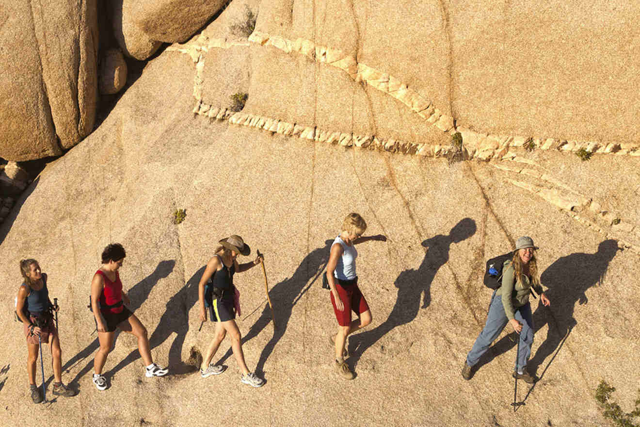
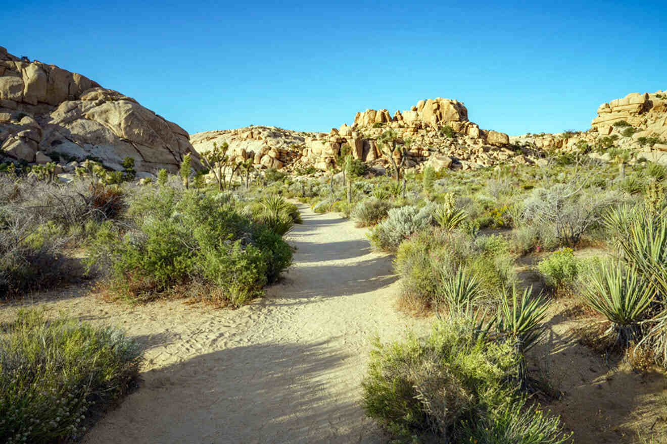
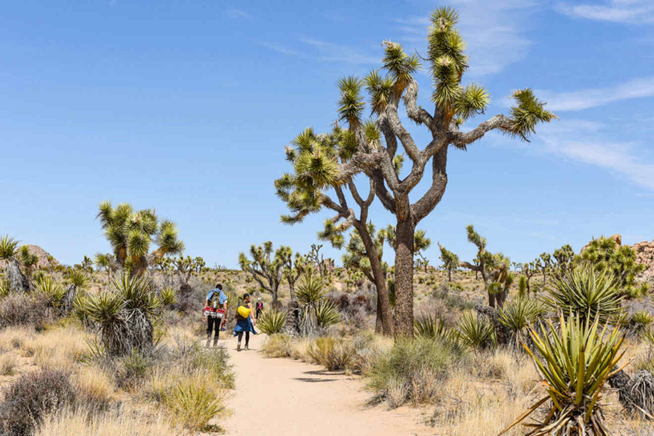
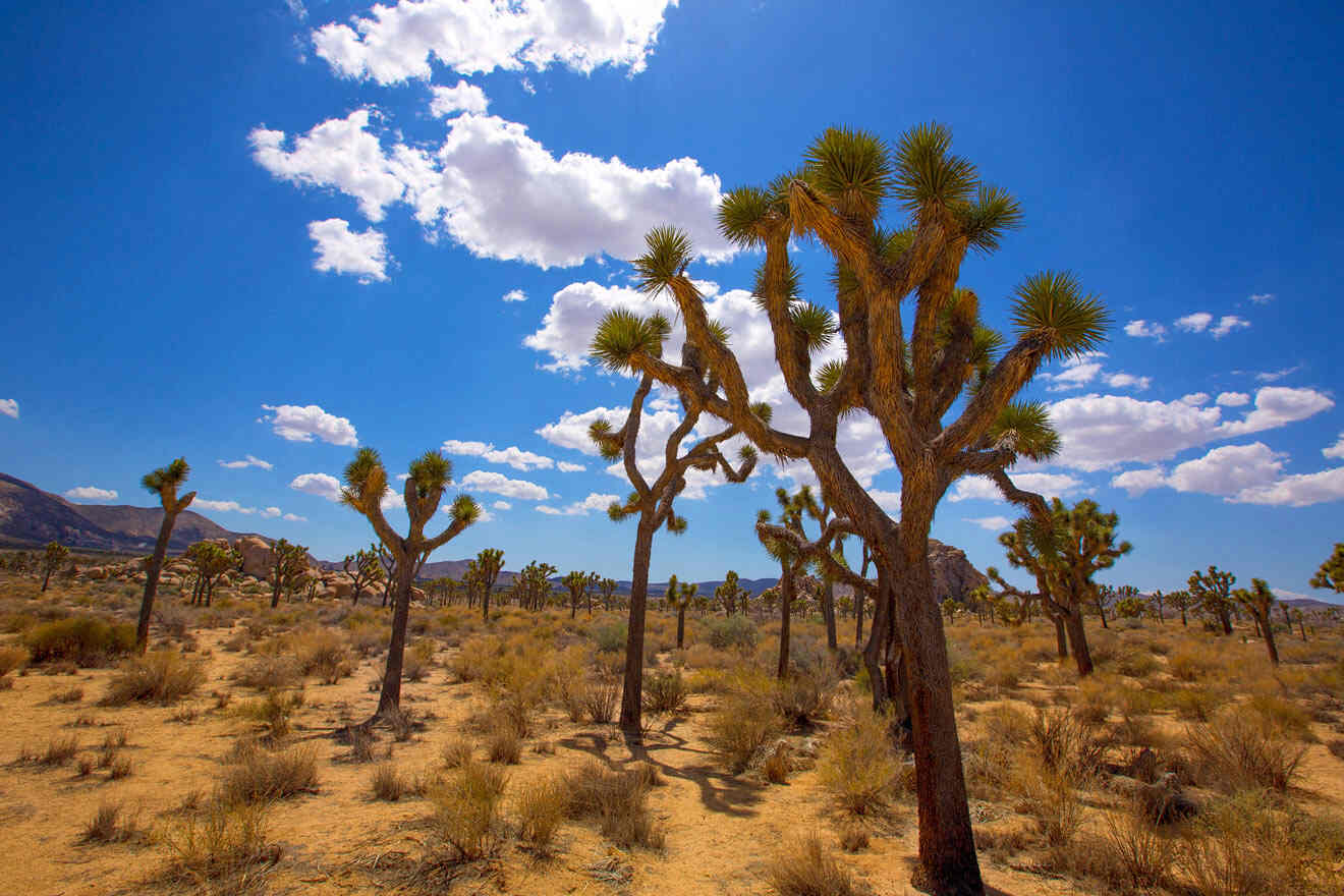
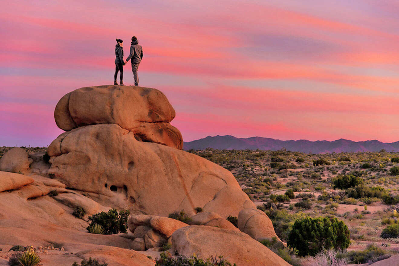
Joshua Tree National Park is home to a variety of unique flora and fauna that can be seen by people like you and me when you visit Joshua Tree. Joshua Tree is made up of a unique desert ecosystem between the Mojave Desert and the Colorado Desert, so everything that this park offers is things you have never seen before.
I’m a true California girl at heart with many years of experience going through this national park (along with many others), and I’ve had the privilege of tackling many different hikes in the park. In this post, I’m going to share with you some of the best hikes in Joshua Tree I’ve done here for both avid hikers and beginners looking for an easy trail.
Along with the basics, I’ll be sharing my best bits of advice for your journey along the way: what to bring, how to save the most $$, where to eat, etc.
Alright, put on your hiking boots, and let’s get started!
Contents
- Quick Picks for Your Stay
- 1. Barker Dam Trail
- 2. Cholla Cactus Garden Trail
- 3. Wall Street Mill Trail
- 4. Ryan Mountain Trail
- 5. Hidden Valley Trail
- 6. Boy Scout Trail
- 7. Arch Rock Trail
- 8. Skull Rock Trail
- 9. Cottonwood Spring
- 10. Discovery Trail
- 11. Black Rock Canyon
- 12. Warren Peak
- FAQs about the best hikes in Joshua Tree
- Conclusion
Quick Picks for Your Stay
Joshua Tree National Park is a humongous park that can get quite overwhelming if you don’t have much time to explore. Sometimes, it’s just easier to join a guided tour to avoid getting lost.
Here are the main things to book in advance:
- Self-guided car audio tour
- Group rock climbing activity
- Joshua Tree National Park scenic vehicle tour
And here are the best hotels: The Box, Joshua Tree (luxury), Joshua Tree Oasis (mid-range), The Getaway (budget)
It’s important to keep in mind that Joshua Tree National Park has 3 main entrances that I’ll be referring to: the North Entrance, the West Entrance, and the South Entrance. The West Entrance is the main entrance, so I’ll refer to it throughout this post.
For your convenience, here’s a map of all the entrances in Joshua Tree and the starting points for each trail below!
1. Barker Dam Trail
📏 Distance: 1.3 miles (2 km)
⏱️ Time: 30 minutes
📈 Difficulty: Easy
📍 Starting point: Barker Dam Road
📌 Endpoint: Barker Dam
The Barker Dam Trail is another easy 1-mile (c. 2 km) hiking loop in Joshua Tree National Park. This trail is filled with iconic Joshua Trees, gigantic rock piles, and (most unique of all) human history and knowledge to be uncovered by hikers and explorers like you!
You’ll find many Native American petroglyphs written on the rock walls, Creosote, Mojave Yuccas, and Pinon Pines, and you may even spot desert bighorn sheep if you stay in the area long enough!
The dam used to be an operating system for ranching efforts among Native Americans. This dam and the rock walls throughout this trail hold a lot of meaning and history, so be sure to respect the space and preserve our history as much as you possibly can by not touching and keeping a safe distance from the dam.
This is a perfect trail to explore with kids who are curious and want to be up close and personal with artifacts and photographers who want to capture and admire the California history that remains here.
TIP: It’s worth checking out a self-driving audio tour that doesn’t require any cell phone service (which is huge!) and will take you around 20 of Joshua Tree National Park’s most sought-after destinations.
TOUR PRICE: US$15
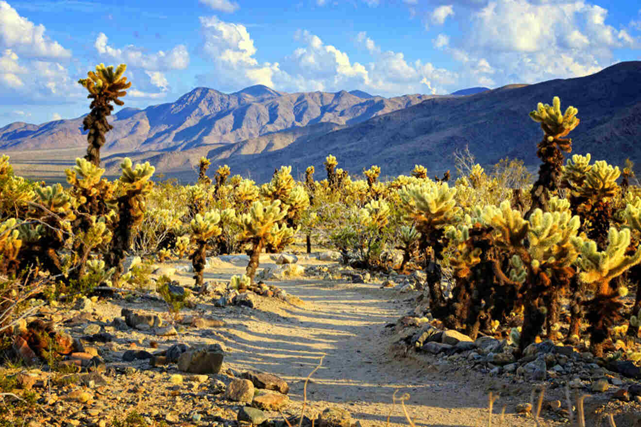
2. Cholla Cactus Garden Trail
📏 Distance: 0.3 miles (0.4 km)
⏱️ Time: 10 minutes
📈 Difficulty: Easy
📍 Starting point: Pinto Basin Road
📌 Endpoint: Cholla Cactus Garden
The Cholla Cactus Garden is a flat landscape garden home to the teddy-bear cholla cacti! This is a beautiful garden, unlike anything you’ve seen before, with wildflowers blooming in the springtime.
It’s located right off Pinto Basin Road, about 20 miles (c. 30 km) north of the Cottonwood Visitor Center and about 10 acres (4 hectares) of land. There’s an easy short loop trail that can be easily done within 30 mins unless you plan on strolling and taking photos, in which case I recommend spending up to an hour here.
The teddy-bear cholla is the main cacti found here, but many others can be found! The hedgehog cactus, brittlebush, desert lavender, beavertail cactus, desert starvine, desert senna, and trixis are a few to keep an eye out for.
Depending on what time of year you visit, you’ll find quite the selection of beautiful wildflowers on all these cacti. To find the majority on your hike in Cholla Cactus Garden, I recommend visiting in the spring months for the “Superbloom” between March and June.
The last time I walked through this flat nature trail, I struggled to find shade anywhere nearby. I recommend bringing a wide-brimmed hat and plenty of water to avoid heat exhaustion and stay hydrated. I can’t stress enough how important it is to come to Joshua Tree National Park well-prepared!
NOTE: It’s also important to remember that anywhere you are in Joshua Tree National Park, there’s little to no phone service. This means that you’ll need to download the entire map of Joshua Tree onto your smartphone. You can easily download the map using Google Maps and navigate where you are, anytime and anywhere.
Subscribe here to get up to 35% off your accommodation for your next trip!
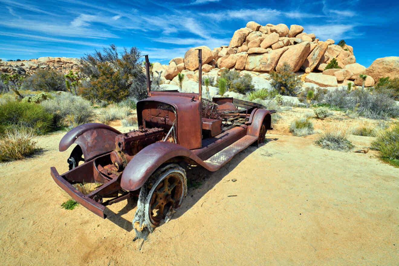
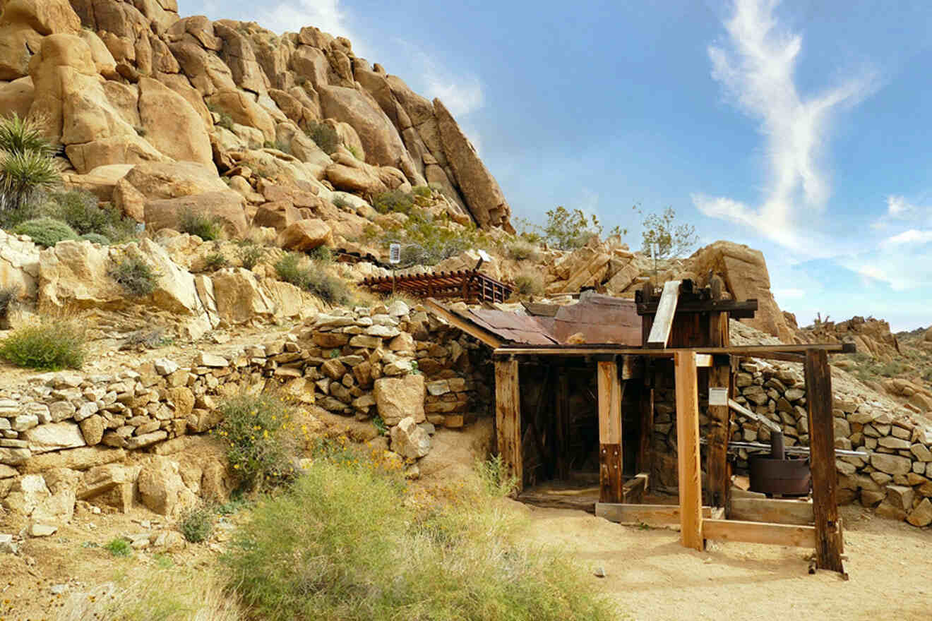
3. Wall Street Mill Trail
📏 Distance: 2 miles (3.2 km)
⏱️ Time: 45 minutes
📈 Difficulty: Easy
📍 Starting point: Wonderland of Rocks Trailhead
📌 Endpoint: Wall Street Mill Site
The Wall Street Mill is a 3-mile (5 km) intermediate hiking trail heading towards an old mill site! The mill was used to process gold from miners that once operated in the area. This is a fascinating historical site to see, with several rusted cars and artifacts that remain in the area.
The trail starts east of the Barker Dam, where you’ll find many people bird watching, hiking, and running since this is a popular location to explore. Expect to find unique rock formations on this flat trail and a dirt path marked by stones to lead you along the way.
I recommend parking at the Barker Dam Trailhead parking lot and follow the signs towards the Wall Street Mill hike. If you’re hiking really early in the morning, I recommend doing both hikes back to back (if you’re not too tired) since they’re located directly next to each other.
PRO TIP: You’ll see a fork in the road the closer you get to the Wall Street Mill hike! There are remains of a pink house on the left-hand side that I recommend exploring. These are the remains of the old Wonderland Ranch! Just remember: don’t steer too far off the beaten path to avoid getting lost!)
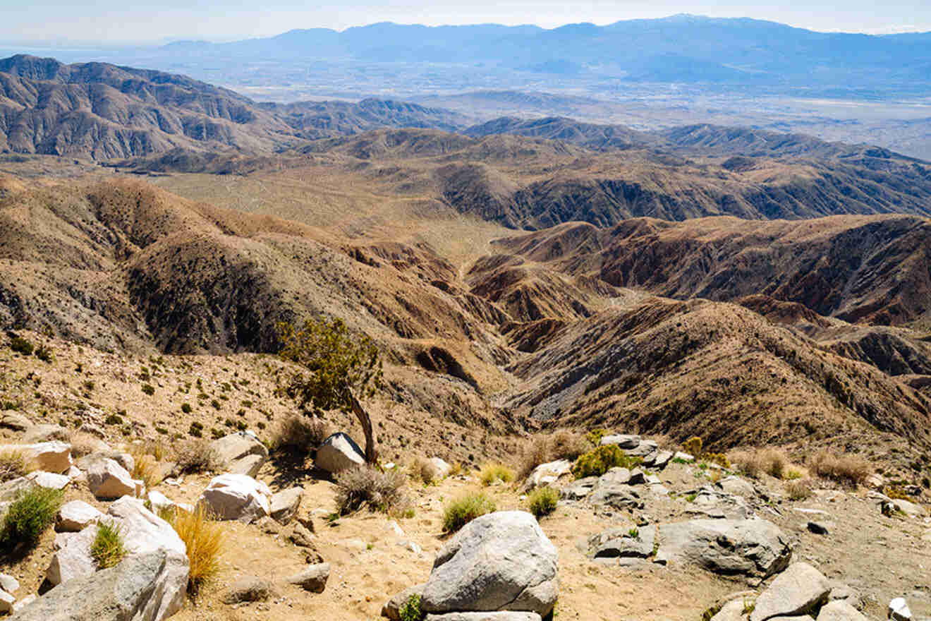
4. Ryan Mountain Trail
📏 Distance: 2.9 miles (4.6 km)
⏱️ Time: 2.5 hours
📈 Difficulty: Easy to moderate
📍 Starting point: Between Ryan Campground and Sheep Pass Campground
📌 Endpoint: Ryan Mountain Peak
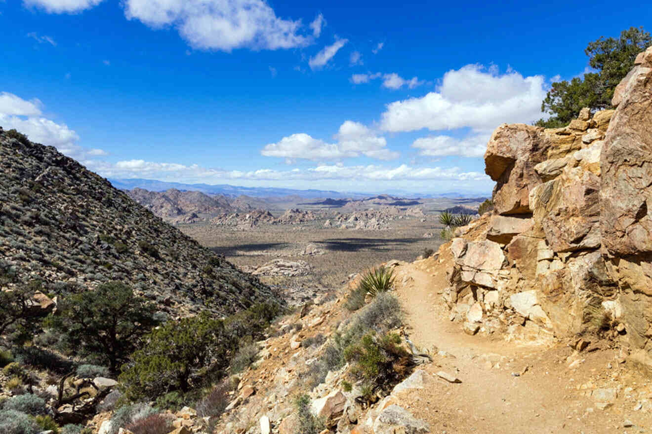
Ryan Mountain Trail is a great hike for intermediate hikers looking for a slight challenge. It’s a 3-mile (5 km) loop that starts with an easy flat walk and has an elevation gain as you start heading up the mountain. It’s one of my favorite hikes in Joshua Tree National Park because it’s a bit more challenging (but not too difficult) and rewarding, with 360-degree views of the entire national park.
Because hiking Ryan Mountain takes about 3 hours to finish, I recommend going early in the morning to avoid the sun hitting you during peak afternoon hours. If you’re not able to hike in the morning (before sunrise is best), I recommend hiking right before the golden hour so you can catch the sunset and it’s not quite as hot.
PRO TIP: I’ve been putting these footbeds in my shoes anytime I’m hiking! It actually saves me the next day from back and foot pain. I recommend trying them out!
5. Hidden Valley Trail
📏 Distance: 1 mile (1.6 km)
⏱️ Time: 20 minutes
📈 Difficulty: Easy
📍 Starting point: Hidden Valley Picnic Area
📌 Endpoint: Hidden Valley
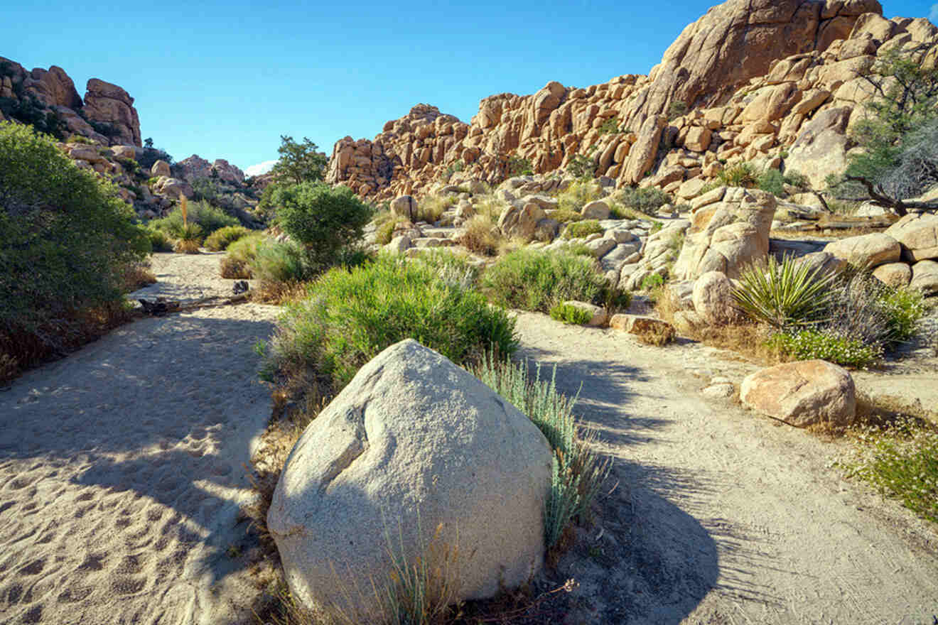
The Hidden Valley Trail near the Hidden Valley Campground is one of the easiest routes in Joshua Tree National Park! This 1-mile (less than 2 km) loop is located on the south side of Park Boulevard, about 9 miles (15 km) east of the West Entrance.
On the Hidden Valley hike, you’ll find some of Joshua Tree’s most breathtaking boulders made of Joshua Tree’s main rock types: quartzite, schist, granofels, and dolostone.
You’ll also get a chance to see the flora and fauna that make up the unique national park. Since Joshua Tree National Park is situated between the Colorado Desert and the Mojave Desert, there’s a unique mix of plants and animals here that you won’t find anywhere else!
Hidden Valley Nature Trail is also the best place to rock climb and watch professional rock climbers! Here are a couple of lines that are popular among rock climbers:
- The Sentinel – The tallest and most impressive rock formation in Hidden Valley! I recommend the Fate Hog line for the easiest and best reputable line at c. 140 feet (c. 40 m).
- Sports Challenge – This is located in the heart of Hidden Valley! The Sphincter Quits is the best line here for beginners at about 70 feet (20 m).
I don’t recommend rock climbing or rock scrambling here unless you have experience or you’re rock climbing with a professional. It does get quite dangerous, and there’s little to no phone service in Joshua Tree, so calling for help can be difficult.
Alternatively, if you really want to try rock climbing or rock scrambling in Joshua Tree, check out this group rock climbing experience with a professional guide.
NOTE: Before embarking on this trail or any trails in Joshua Tree National Park, it’s important to keep in mind that weather and wind conditions may affect trail closures. I recommend checking the website for rock climbing updates, trail closures, and other safety precautions.
TOUR PRICE: from US$190
6. Boy Scout Trail
📏 Distance: 8 miles (12.8 km)
⏱️ Time: 4 hours
📈 Difficulty: Advanced
📍 Starting point: Keys West Trailhead
📌 Endpoint: Indian Cove Campground
The Boy Scout Trail is one of the longest hiking nature trails on this list! The distance looping around is 8 miles (13 km), and the hike is located within the Boy Scout Trail Zone, between Indian Cove to the Boy Scout Backcountry Trailhead.
On this Joshua Tree day hike, expect to find breathtaking views of the famous Joshua Trees, the highest peak in SoCal at the San Gorgonio Mountain, vistas, canyons, large rock formations, and cliffs. The elevation gain fluctuates throughout the trail, hitting a maximum of 4,240 feet (c. 1,290 m).
Unlike many spots throughout Joshua Tree National Park, dispersed camping isn’t allowed here! If you want to camp here, you’ll need to stay at a site designated for campers. You can read more about the campsites here.
The hike is flat for about halfway and descends for the second half. On your way back up, you’ll have to hike uphill, so save your energy for the way back! If it’s getting too late or you don’t feel well enough to complete the entire hike, turn back around at the viewpoint about 5 mi (7 km) in.
PRO TIP: Make sure to slather on your sunscreen! I recommend this UV-protecting sunscreen from Shiseido for your face and this easy spray-on sunscreen for the rest of your body (and make sure to reapply throughout the day, too)!
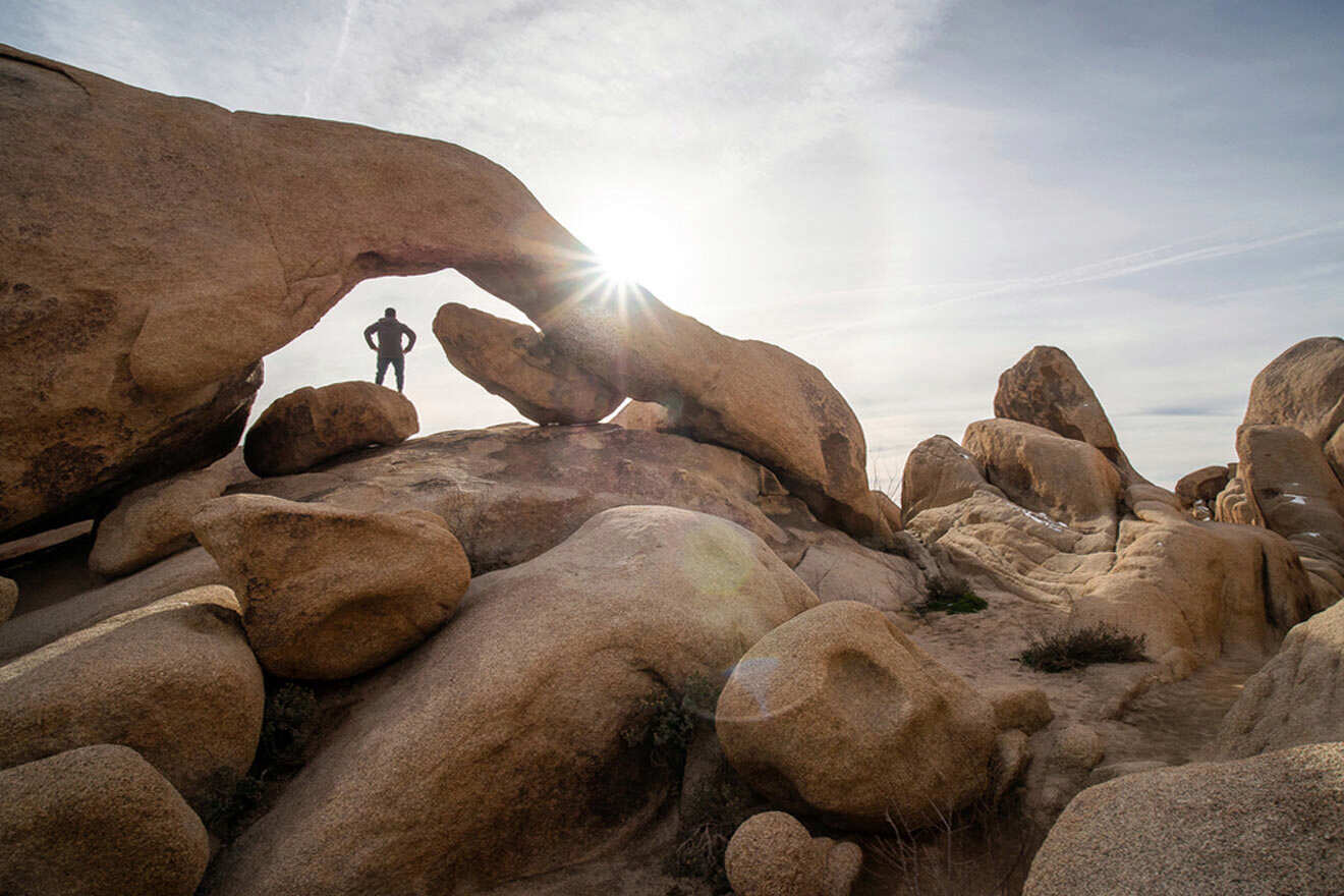
7. Arch Rock Trail
📏 Distance: 1.4 miles (2.25 km)
⏱️ Time: 30 minutes
📈 Difficulty: Easy
📍 Starting point: White Tank Campground
📌 Endpoint: Arch Rock
The Arch Rock hike is an easy nature walk located near the White Tank Campground that goes in a straight line with little to no elevation gain. It’s a bit over 1 mile (c. 1 km) from the parking lot, making this an easy hike for families, beginner hikers, or if you’re feeling exhausted from a day of hiking!
For a better experience, I recommend taking the counterclockwise route from the parking lot. It’s the easiest way to spot the Arch Rock ahead. The hike starts at a sandy location but becomes rocky as you approach the Arch Rock.
PRO TIP: Take a detour into more of the Joshua Tree wilderness to visit Heart Rock nearby! This gigantic heart-shaped rock is a famous attraction worth checking out and snapping photos with while you’re here.
Pay attention to the beautiful rock formations you’re passing through this Arch Rock hike and read the educational signs posted on the trail about the geology and rock formations. One of the best parts of Joshua Tree is the abundance of information to be learned and admired!
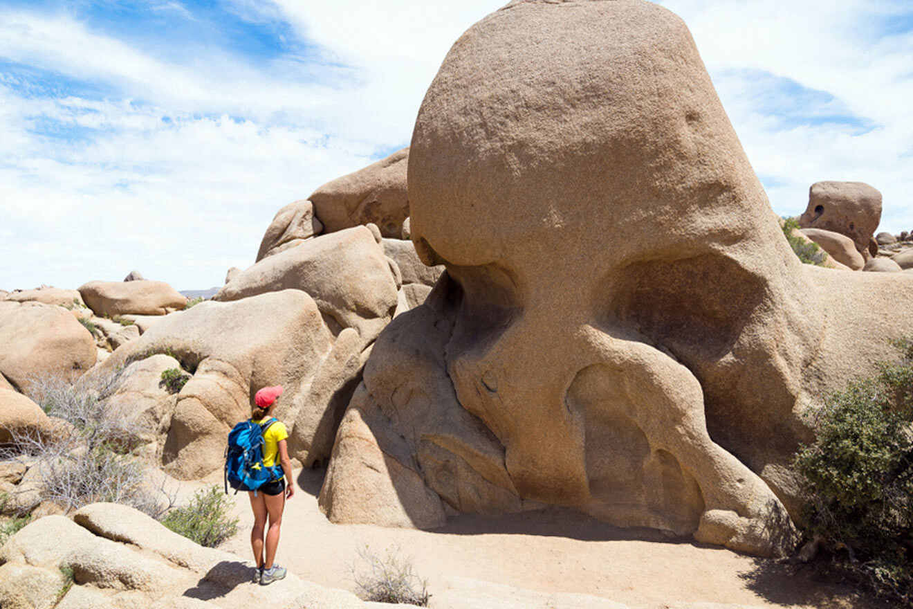
8. Skull Rock Trail
📏 Distance: 1.7 miles (2.7 km)
⏱️ Time: 45 minutes
📈 Difficulty: Easy
📍 Starting point: Jumbo Rocks Campground
📌 Endpoint: Skull Rock
Skull Rock Nature Trail is among one of the most famous Joshua Tree trails! The shape of the skull rock boulder was formed by the natural process of water erosion over time and, today, resembles a gigantic skull! This is a fun, easy hike to do with kids and snap photos by!
There are a couple of ways to get to Skull Rock, but I recommend taking the hiking trail so you can take in the views along the way and make the most out of the experience.
The hiking trail is an app. 2-mile (c. 3 km) loop, located right on Jumbo Rocks Campground. I recommend easily following the signs reading “Skull Rock” along the way. I’ve gotten lost a few times by forgetting to read the signs (which can turn into a nightmare if you’re not careful), so make sure you’re paying attention!
If you’re looking to snap a few quick photos without going through the entire trail, you can easily park at the parking lot located a short walk away.
PRO TIP: The sand and rocks beneath your feet can get slippery if you’re not wearing the right shoes. I recommend wearing hiking boots with a good grip on the bottom to prevent slipping while hiking Joshua Tree National Park trails.
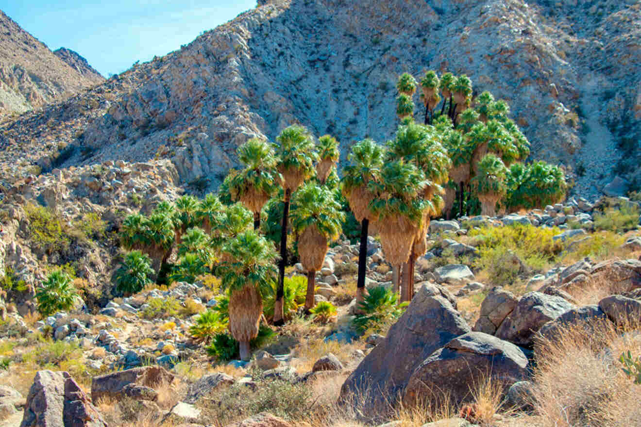
9. Cottonwood Spring
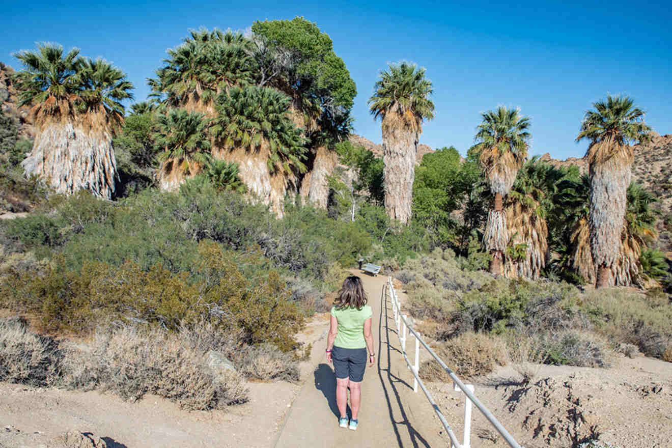
Cottonwood Spring Oasis is a must-see when in Joshua Tree National Park! This natural spring is located an hour south of the West Entrance, so I recommend going on a separate day when you can explore this area by car. Here, you’ll find bedrock mortars, clay pots, and other handmade instruments in and around the oasis since the oasis was used for centuries by Native Americans!
There are a few hikes starting at Cottonwood Spring Oasis that I recommend checking out:
9.1 Fortynine Palms Oasis Trail
📏 Distance: 3 miles (4.8 km)
⏱️ Time: 1.5 hours
📈 Difficulty: Easy
📍 Starting point: Fortynine Palms Canyon Road
📌 Endpoint: Fortynine Palms Canyon
The Fortynine Palms Oasis Trail (also known as Lost Palms Oasis Trail) is one of the best hikes in Joshua Tree. This is the best choice for advanced hikers looking for a greater challenge. It’s an 8-mile (13 km) roundtrip hiking trail leading to a Palm Tree oasis in the middle of the desert. It’s quite a sight to see, and I 100% recommend checking it out!
NOTE: The trail isn’t clearly paved that well, so it’s easy to get lost here if you don’t follow the signs! Take your time and watch for signs to avoid getting stuck.
9.2 Cottonwood Wash
📏 Distance: 0.8 miles (1.2 km)
⏱️ Time: 20 minutes
📈 Difficulty: Moderate
📍 Starting point: Cottonwood Spring
📌 Endpoint: Cottonwood Wash
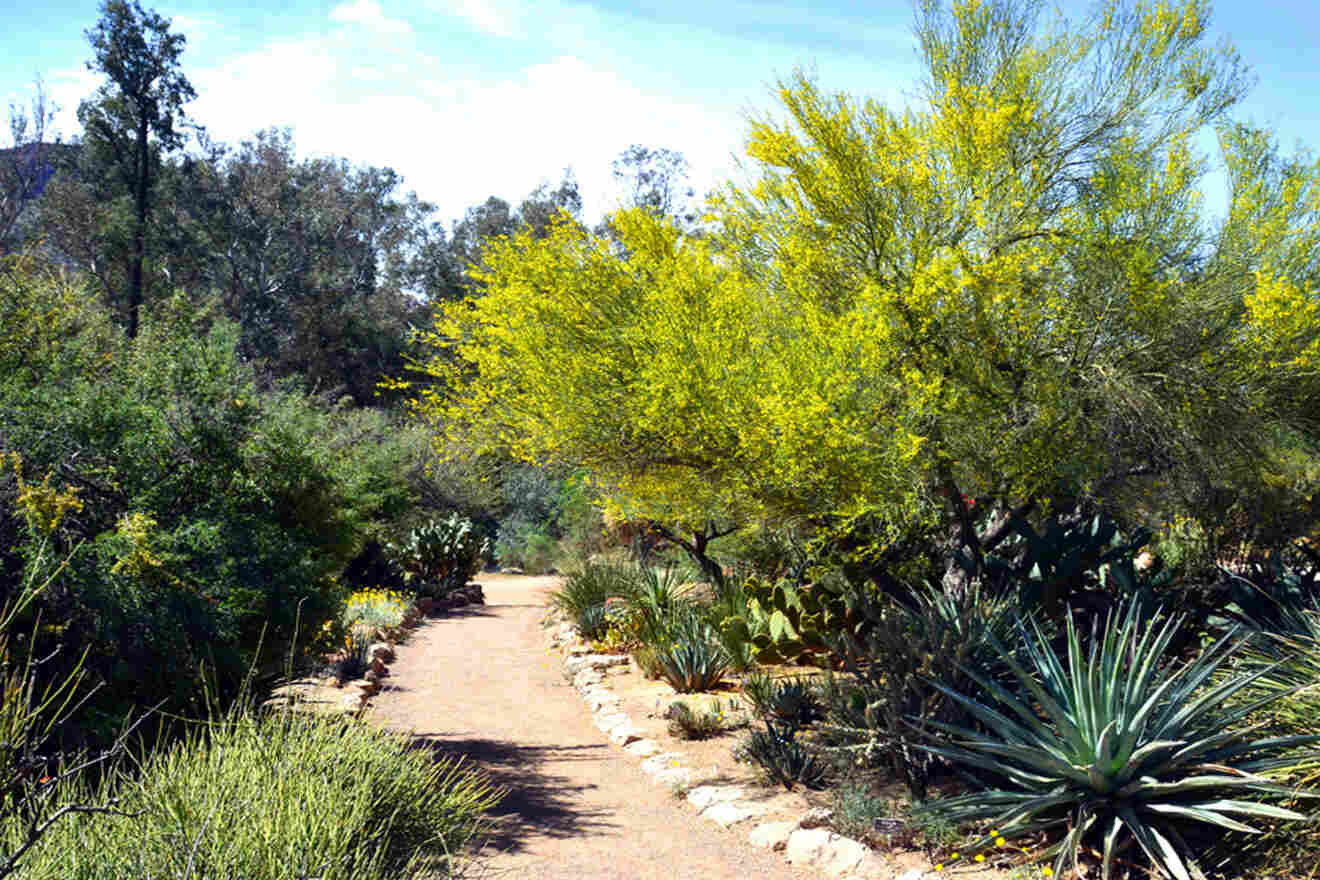
Walk towards the Cottonwood Wash for a dry oasis during the winter and springtime! Depending on the time of year, you might also find rushing water and red-spotted toads. For more, you can take an easy walk here through Palo Verde, and you’ll pass by Moorten’s Mill, a historic site worth checking out. This is also where bighorn sheep drink water, so keep an eye out for them!
As you can imagine, there are all kinds of creatures here! From mosquitos to snakes, getting bit by anything while you’re in Joshua Tree National Park is one of the worst things that can happen.
Avoid getting bit by wearing a long sleeve sweat-resistant shirt and long pants. I also recommend bringing an insect repellent to be extra careful. I carry this one around in my backpack anytime I’m hiking.
9.3 Mastodon Peak
📏 Distance: 3 miles (4.8 km)
⏱️ Time: 2.5 hours
📈 Difficulty: Easy
📍 Starting point: Cottonwood Springs Oasis
📌 Endpoint: Mastodon Peak Summit
Mastodon Peak is a 3-mile (5 km) loop that is pretty moderate with about 375 feet (c. 110 m) of elevation gain. This is an excellent hiking trail with views of the southern point of view of Joshua Tree National Park, passing by the fork that takes you to 49 Palms Trail. You can even scramble up to the top of the granite peak here!
TIP: Instead of passing the 49 Palms Trail at the fork, you can make your hike longer by combining it with 49 Palms!
NOTE: Planning what time you’re leaving any hike you’re doing in Joshua Tree National Park is just as essential as planning your trip there. If you don’t plan your departure on time, the sun will go down, and it will be incredibly dangerous to be out in the desert at that time without any cell service.
10. Discovery Trail
📏 Distance: 0.7 miles (1.1 km)
⏱️ Time: 20 minutes
📈 Difficulty: Easy
📍 Starting point: Jumbo Rocks Campground
📌 Endpoint: Connects To Skull Rock & Split Rock Loop
Discovery Trail is less than 1 mile (less than 2 km) loop located along Park Boulevard between Jumbo Rocks and Live Oak. The trailhead is on the north side near Skull Rock! You will come across signs leading to Discovery Trail as you’re looping around Skull Rock Trail, so doing both back to back might be a good idea if it’s not too late or you’re not too tired.
Expect this trail to have large rock formations, stairs, and some steep and narrow sections. It’s a short, relatively new (about 10 years old) trail that was created by a group of local students catered to interest fellow students and kids!
With that said, this hike is a wonderful one if you’re traveling with kids. It’s not too long; you’ll see tons of educational posts along the way, there are fixed binoculars with an illustrated sign, and it’s quite literally made for kids to enjoy!
NOTE: I recommend parking along Park Boulevard on the opposite side of Skull Rock. There will be a sign at the trailhead – go clockwise for the best experience!
11. Black Rock Canyon
📏 Number of trails: 5
⏱️ Time: Between 30 minutes to 3 days
📈 Difficulty: Easy to Advanced
📍 Starting point: Black Rock Canyon Campground
📌 Endpoint: Varies
Block Rock Canyon offers some of the best hikes in Joshua Tree and the best desert camping experiences you can ever have! The family-friendly Black Rock Canyon campground is ideal for beginner campers. It’s located about 5 miles (8 km) away from Yucca Valley, so if you end up forgetting anything (as beginners often do), you can head into town to buy anything you need.
There are hiking trails near the campground that I recommend checking out:
- Black Rock Canyon Trail – This circa 4-mile (c. 6 km) hike is the most popular trail in Black Rock Canyon for hiking, bird watching, camping, etc. since it’s a relatively easy, flat hike.
- Hi-View Nature Trail – A little over 1 mile (c. 2 km) loop hike that ascends 400 feet (120 m) of elevation gain where you get stunning views of the San Jacinto and San Gorgonio mountains. Notice all the Joshua Trees and juniper trees on your way up!
- Eureka Peak – This is Joshua Tree National Park’s 5th highest peak! It’s about 10 mi (16 km) round trip, only recommended for professionals and avid hikers, and make sure to go before sunrise to get the best view and safest experience.
- Panorama Loop – Enjoy the scenic views of the Little San Bernardino Mountains, large Joshua Trees, and more on this c. 7-mile (11 km) trail! There are over 1,000 feet (c. 300 m) of elevation gain, and you can get to Warren Peak from here. I recommend planning ahead and using your map because there are quite a few trails that intersect here.
- California Riding and Hiking Trail – The California Riding and Hiking Trail is a 2 – 3 day hike covering about 40 miles (60 km) of some of the most remote areas in Joshua Tree. There are campsites along the way to stop at, and it requires a ton of planning ahead! I recommend this for pros who are well-versed and know what they’re doing.
You can also go horseback riding through the California Riding and Hiking Trail through Knob Hill Ranch! Make sure to book in advance to secure your spot!
PRO TIP: Joshua Tree is home to unique species of birds that I recommend looking out for! Bring binoculars and go bird watching at Black Rock Campground for the best wildlife sightings.
12. Warren Peak
📏 Distance: 6 miles (9.6 km)
⏱️ Time: 3.5 hours
📈 Difficulty: Moderate
📍 Starting point: Black Rock Canyon (backcountry board and trailhead)
📌 Endpoint: Warren Peak Summit
Looking for something a little rougher but not quite as long as the California Riding and Hiking Trail or Eureka Peak? Warren Peak is considered a very challenging hike in Joshua Tree with its 6-mile (c. 10 km) round-trip route.
It starts with a sandy wash making it a bit difficult to walk through, leading to a slight incline heading all the way up and a climb up at the top to wrap it up. The hike is well worth the challenge with the panoramic views of the entire park!
PRO TIP: Tired of all the Joshua Tree hiking trails? I recommend taking a day to just relax in the backseat of an air-conditioned vehicle and watching the Joshua Trees and unique landscape pass you by! This half-day tour does exactly this, giving you a break from the desert sun.
NOTE: There are tons of wildlife here, so be cautious of your surroundings while you’re hiking.
TOUR PRICE: from US$200
| 😌 Best hike: | Ryan Mountain Trail |
| 🥾 Longest hike: | California Riding and Hiking Trail |
| 🧗♂️ Best activity for groups: | Rock Climbing |
| 👨👩👧 Best hike for kids: | Discovery Trail |
FAQs about the best hikes in Joshua Tree

🥾 What are the best trails to hike in Joshua Tree National Park?
The best Joshua Tree hikes are the Hidden Valley Hike, 49 Palms Oasis, Barker Dam Trail, and Wall Street Mill Trail. They each have views and artifacts that make them particularly unique and unlike anything else in Joshua Tree National Park.
🌵 What shouldn’t I miss at Joshua Tree National Park?
You shouldn’t miss Ryan Mountain and Cholla Cactus Garden in Joshua Tree National Park. They offer some of the best beautiful desert views and natural phenomena in California.
⛰️ What is the hardest hike in Joshua Tree National Park?
The hardest hike in Joshua Tree National Park is the California Riding and Hiking Trail app. 40 miles (60 km) long, and the Warren Peak Trail has a slight incline all the way up for 6 miles (10 km).
🏜️ What are the best experiences in Joshua Tree National Park?
The best experiences in Joshua Tree National Park are hiking, camping, bird watching, and rock climbing!
Conclusion
Well, there you have it! Ready to embark on your Joshua Tree hiking journey? There are SO many beautiful hikes to choose from, and picking the best hikes in Joshua Tree really depends on your own personal preferences!
Whether you like short loops with scenic views along the way, unique geology that will blow your mind, or the adventure of 10+ mile hikes, there’s a hike for everyone to enjoy in Joshua Tree National Park.
My top 2 favorite hikes in Joshua Tree have to be Ryan Mountain Trail and the Cholla Cactus Garden! Being on top of Ryan Mountain is simply breathtaking, and I can’t get over the views. Cholla Cactus Garden is the most beautiful thing in the entire national park during the seasonal “Super bloom,” and I’m a sucker for wildflowers. What can I say?
Don’t forget to plan your hikes, activities, and tours in advance and follow all my tips and tricks to stay safe when hiking in Joshua Tree!
Thank you for taking the time to read through this post, and enjoy your stay in Joshua Tree! If you do decide to go on any of these hikes, let me know in the comments below! 💌
Xoxo,
Esabel S.
Pin it for later!

Pin it for later!


This site is protected by reCAPTCHA and the Google Privacy Policy and Terms of Service apply.